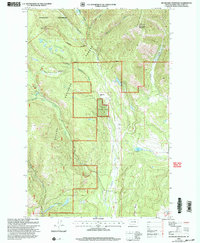
2001 Map of Silver King Mountain
USGS Topo · Published 2004About this map
Silver King Mountain dominates this remote landscape within the Helena National Forest and Scapegoat Wilderness, a region characterized by high mountain peaks and deep glacial drainages. This early 21st-century revision reveals the administrative and recreational footprint of the Lincoln Ranger District, featuring the Indian Meadows Work Center and the Silver King Ranch. The map captures a detailed hydrographic network including Landers Fork, Copper Creek, and a series of alpine waters such as Keep Cool Lakes and Snowbank Lake. For researchers of western land management, the presence of the Elk Trail Landing Strip and designated Fishing Access points highlights the intersection of wilderness preservation and public utility in the Alice Mountains backcountry.
Find a feature on this map
23 named features on this map. Tap any name to fly to it.
Don’t see what you’re looking for? This feature index may not catch every label — zoom into the map to look around manually.
Map Details
Editions of this 2001 Silver King Mountain Map
This is the sole edition of this map. No revisions or reprints were ever made.
Other maps of this area

1889 · Helena
USGS Topo · 1:250,000

1893 · Helena
USGS Topo · 1:250,000

1899 · Helena
USGS Topo · 1:250,000

1903 · Coopers Lake
USGS Topo · 1:125,000

1903 · Helena
USGS Topo · 1:250,000

1943 · Hogan
USGS Topo · 1:125,000

1947 · Butte
USGS Topo · 1:250,000

1955 · Choteau
USGS Topo · 1:250,000

1957 · Choteau
USGS Topo · 1:250,000

1958 · Butte
USGS Topo · 1:250,000