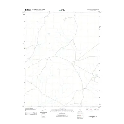
2012 Map of Silver King Well
USGS Topo · Published 2012About this map
Silver King marks the central point of interest in this high-desert landscape, where the scarcity of water dictated the locations of every outpost and waypoint. This 2012 survey documents a network of critical water sources, including Trough Spring and Horse Spring to the north, which sustained travelers and livestock across the arid terrain. The presence of the Silver King Well and Wolf Hole Spring highlights the essential infrastructure of this Nevada cattle and mining region, showing how remote sites remained anchored to these reliable springs. The map’s road network connects these points, illustrating the modern utility of historic paths that have long linked Perry Spring to the broader desert floor.
Find a feature on this map
6 named features on this map. Tap any name to fly to it.
Don’t see what you’re looking for? This feature index may not catch every label — zoom into the map to look around manually.
Map Details
Editions of this 2012 Silver King Well Map
This is the sole edition of this map. No revisions or reprints were ever made.
Other maps of this area

1956 · Lund
USGS Topo · 1:250,000

1960 · Lund
USGS Topo · 1:250,000

1969 · Gap Mountain
USGS Topo · 1:24,000

1969 · Sunnyside
USGS Topo · 1:24,000

1971 · Sidehill Spring
USGS Topo · 1:24,000

1971 · Bailey Wash
USGS Topo · 1:24,000
1971 · Timber Mtn Pass NE
USGS Topo · 1:24,000

1971 · Cave Valley Well
USGS Topo · 1:24,000

1971 · Silver King Mtn
USGS Topo · 1:24,000

1971 · Sidehill Pass
USGS Topo · 1:24,000