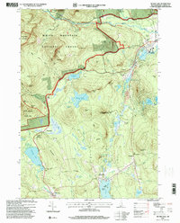
1995 Map of Silver Lake
USGS Topo · Published 2000About this map
White Mountain National Forest dominates the northwest corner of this terrain, where the peaks of Mount Chocorua Scenic Area and Bald Mountain overlook a complex network of hiking routes including the Chocorua Trail and Bolles Trail. The landscape is defined by its dramatic granite ledges and numerous glacial water bodies, from the expansive Silver Lake in the south to the smaller, high-elevation Whitton Pond and Iona Lake. The Kancamagus Scenic Byway winds through the northern section alongside the Swift River, marking the corridor for modern travel through the peaks.
Find a feature on this map
84 named features on this map. Tap any name to fly to it.
Don’t see what you’re looking for? This feature index may not catch every label — zoom into the map to look around manually.
Map Details
Editions of this 1995 Silver Lake Map
This is the sole edition of this map. No revisions or reprints were ever made.
Other maps of this area

1894 · North Conway
USGS Topo · 1:62,500

1895 · Crawford Notch
USGS Topo · 1:62,500

1896 · Crawford Notch
USGS Topo · 1:62,500

1896 · North Conway
USGS Topo · 1:62,500

1930 · Ossipee Lake
USGS Topo · 1:62,500

1931 · Mt. Chocorua
USGS Topo · 1:62,500

1942 · North Conway
USGS Topo · 1:62,500

1945 · North Conway
USGS Topo · 1:62,500

1946 · Crawford Notch
USGS Topo · 1:62,500

1949 · Portland
USGS Topo · 1:250,000