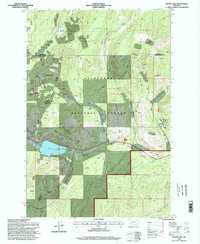
1996 Map of Silver Lake
USGS Topo · Published 1998About this map
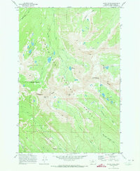
Cable Mountain dominates this high-altitude landscape in the mid-1990s, where the legacy of Montana's mineral extraction is visible in every drainage. The map records a dense concentration of mining activity between Southern Cross and Georgetown, featuring the Cable Mine, Gold Coin Mine, and numerous unnamed prospects. These operations follow the rugged ridges of the Deerlodge National Forest, tracing the geological seams from Silver Hill north toward Hidden Lake Mine.
Find a feature on this map
51 named features on this map. Tap any name to fly to it.
Don’t see what you’re looking for? This feature index may not catch every label — zoom into the map to look around manually.
Map Details
Editions of this 1996 Silver Lake Map
This is the sole edition of this map. No revisions or reprints were ever made.
Other maps of this area

1908 · Philipsburg
USGS Topo · 1:125,000

1947 · Butte
USGS Topo · 1:250,000

1958 · Butte
USGS Topo · 1:250,000

1960 · Butte
USGS Topo · 1:250,000

1962 · Butte
USGS Topo · 1:250,000

1971 · Georgetown Lake
USGS Topo · 1:24,000
1971 · West Valley
USGS Topo · 1:24,000
1971 · Philipsburg
USGS Topo · 1:24,000
1971 · Fred Burr Lake
USGS Topo · 1:24,000
1971 · Mount Evans
USGS Topo · 1:24,000