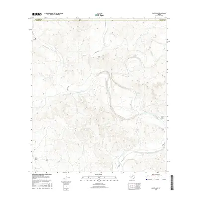
2016 Map of Silver Lake
USGS Topo · Published 2016About this map
The W Nueces River carves a winding path through this corner of the Edwards Plateau, where the landscape is defined by its intermittent water sources and ranching infrastructure. This arid terrain in Kinney and Edwards Counties reveals a system of essential watering points for livestock and wildlife, including the Dutch Waterhole, Blue Waterhole, and the namesake Silver Lake. The reliance on local aviation for large-scale land management is evident through several private landing strips scattered across the hills, such as the Spring Ranch Airport, Leona Ranch Airport, and L Davis Ranch Airport. Rising above the river valley, prominent topographical features like Dutch Mtn and Black Mtn overlook a network of backcountry roads, including Cedar Creek Rd and Tularosa Rd, that connect these isolated ranch holdings.
Find a feature on this map
22 named features on this map. Tap any name to fly to it.
Don’t see what you’re looking for? This feature index may not catch every label — zoom into the map to look around manually.
Map Details
Editions of this 2016 Silver Lake Map
This is the sole edition of this map. No revisions or reprints were ever made.
Other maps of this area

1893 · Nueces
USGS Topo · 1:125,000

1896 · Nueces
USGS Topo · 1:125,000

1896 · Brackett
USGS Topo · 1:125,000

1897 · Brackett
USGS Topo · 1:125,000

1938 · Turkey Mountain
USGS Topo · 1:48,000

1943 · Turkey Mountain
USGS Topo · 1:62,500

1944 · Barksdale
USGS Topo · 1:62,500

1944 · Brackettville
USGS Topo · 1:62,500

1944 · Indian Mountain
USGS Topo · 1:62,500

1958 · Del Rio
USGS Topo · 1:250,000