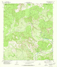
1974 Map of Silver Lake
USGS Topo · Published 1977About this map
West Nueces River carves through the canyonlands of the Edwards Plateau on this mid-1970s survey of the border between Edwards and Kinney counties. The landscape is defined by intermittent drainages and critical desert water sources, including the namesake Silver Lake and the Long Lake basin. Ranching activity is evident at the Silver Lake Ranch, while several instances of a Landing Strip and numerous segments of Jeep Trail suggest a reliance on air and off-road travel for traversing these remote limestone uplands.
Find a feature on this map
22 named features on this map. Tap any name to fly to it.
Don’t see what you’re looking for? This feature index may not catch every label — zoom into the map to look around manually.
Map Details
Editions of this 1974 Silver Lake Map
This is the sole edition of this map. No revisions or reprints were ever made.
Other maps of this area

1893 · Nueces
USGS Topo · 1:125,000

1896 · Nueces
USGS Topo · 1:125,000

1896 · Brackett
USGS Topo · 1:125,000

1897 · Brackett
USGS Topo · 1:125,000

1938 · Turkey Mountain
USGS Topo · 1:48,000

1943 · Turkey Mountain
USGS Topo · 1:62,500

1944 · Barksdale
USGS Topo · 1:62,500

1944 · Brackettville
USGS Topo · 1:62,500

1944 · Indian Mountain
USGS Topo · 1:62,500

1958 · Del Rio
USGS Topo · 1:250,000