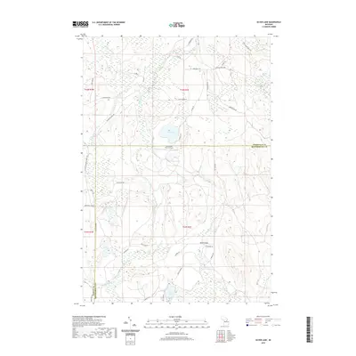
2019 Map of Silver Lake
USGS Topo · Published 2019About this map
Black River and its various forks dominate this northern Michigan landscape, where the Cheboygan and Otsego county lines meet Montmorency County. The area is defined by a dense network of water bodies, from the central expanse of Silver Lake and the southern Foch Lakes to smaller features like Stewart Lake and Dollar Lake. A mix of established routes and back-country paths, such as Canada Creek Hwy and Scenic Rte 3, provide access to this water-rich territory.
Find a feature on this map
40 named features on this map. Tap any name to fly to it.
Don’t see what you’re looking for? This feature index may not catch every label — zoom into the map to look around manually.
Map Details
Editions of this 2019 Silver Lake Map
This is the sole edition of this map. No revisions or reprints were ever made.
Other maps of this area

1954 · Hetherton
USGS Topo · 1:62,500

1955 · Atlanta
USGS Topo · 1:62,500

1955 · Cheboygan
USGS Topo · 1:250,000

1957 · Tower
USGS Topo · 1:62,500

1957 · Onaway
USGS Topo · 1:62,500

1958 · Cheboygan
USGS Topo · 1:250,000

1982 · Petoskey
USGS Topo · 1:100,000
1986 · Onaway
USGS Topo · 1:24,000

1986 · Silver Lake
USGS Topo · 1:24,000
1986 · Saunders Creek
USGS Topo · 1:24,000