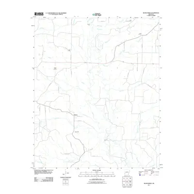
2011 Map of Silver Ridge
USGS Topo · Published 2011About this map
The Saline River corridor dominates this Sevier County landscape, creating a network of riparian crossings and agricultural settlements at the start of the 21st century. River access remains central to the area's geography, evidenced by historical crossing points like Murphy Ford in the north and Saltworks Ford to the south. The small communities of Silver Ridge and Milford serve as local anchors, connected by a grid of rural routes including Silver Ridge Rd and Milford Rd. For genealogists, the map identifies several distinct burial grounds, such as Mount Carmen Cemetery, Coulter Cemetery, and Kingree Chapel Cemetery, which provide clues to family settlement patterns in the vicinity of Steele Hill. Numerous tributaries including Sand Creek, Brushy Creek, and Prairie Creek carve through the terrain, illustrating the complex drainage system feeding into the main river channel.
Find a feature on this map
41 named features on this map. Tap any name to fly to it.
Don’t see what you’re looking for? This feature index may not catch every label — zoom into the map to look around manually.
Map Details
Editions of this 2011 Silver Ridge Map
This is the sole edition of this map. No revisions or reprints were ever made.
Other maps of this area

1906 · Caddo Gap
USGS Topo · 1:125,000

1913 · De Queen
USGS Topo · 1:125,000

1950 · Mcalester
USGS Topo · 1:250,000

1950 · Ben Lomond
USGS Topo · 1:24,000

1950 · Falls Chapel
USGS Topo · 1:24,000

1951 · Ben Lomond
USGS Topo · 1:24,000

1951 · Falls Chapel
USGS Topo · 1:24,000

1951 · Mineral Springs South
USGS Topo · 1:24,000

1951 · Lockesburg
USGS Topo · 1:24,000

1951 · Mineral Springs North
USGS Topo · 1:24,000