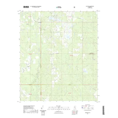
2021 Map of Silver Run
USGS Topo · Published 2021About this map
Silver Run and the neighboring settlement of Barth anchor this southern Mississippi landscape, where the Wolf River and Little Biloxi River drainage systems define the local geography. The map reveals a deeply rooted rural community evidenced by family-named landmarks and cemeteries, including Dedeaux Cem, Hester Cem, and Ladner Cem. Much of the eastern portion is occupied by the De Soto National Forest, showing a transition from private holdings to protected timberlands. A series of small water bodies like Silver Run Lakes, Red Gap Lake, and Happy Lake are scattered among the ridges and brakes. The presence of Big Swamp and Byrd Reed Brake indicates the low-lying, poorly drained terrain that historically challenged road construction, forcing the network of local routes like Silver Run Rd and Old Hwy 26 to follow the high ground of features like Kaiwa Ridge.
Find a feature on this map
66 named features on this map. Tap any name to fly to it.
Don’t see what you’re looking for? This feature index may not catch every label — zoom into the map to look around manually.
Map Details
Editions of this 2021 Silver Run Map
This is the sole edition of this map. No revisions or reprints were ever made.
Other maps of this area

1947 · Wiggins
USGS Topo · 1:62,500

1949 · Wiggins
USGS Topo · 1:62,500

1953 · Mobile
USGS Topo · 1:250,000

1954 · McHenry
USGS Topo · 1:62,500

1955 · Savannah
USGS Topo · 1:62,500

1957 · Mobile
USGS Topo · 1:250,000

1958 · Carnes
USGS Topo · 1:62,500

1960 · Mobile
USGS Topo · 1:250,000

1963 · Mobile
USGS Topo · 1:250,000

1965 · Mobile
USGS Topo · 1:250,000