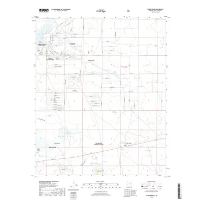
2018 Map of Silver Springs
USGS Topo · Published 2018About this map
The high country of northeastern Arizona, where the residential developments of White Mountain Lakes Estates meet the managed wilderness of the Sitgreaves National Forest, is documented in this 2018 survey. The landscape is characterized by its volcanic topography, featuring named landmarks such as Cooley Knoll, First Knoll, and Second Knoll. A complex network of water resources, essential for the region's high-altitude ecology, is visible through a series of tanks and lakes, including Little Mormon Lake, Whipple Lake, and the expansive White Mountain Lake.
Find a feature on this map
84 named features on this map. Tap any name to fly to it.
Don’t see what you’re looking for? This feature index may not catch every label — zoom into the map to look around manually.
Map Details
Editions of this 2018 Silver Springs Map
This is the sole edition of this map. No revisions or reprints were ever made.
Other maps of this area

1886 · St Johns
USGS Topo · 1:250,000

1886 · Holbrook
USGS Topo · 1:250,000

1892 · St Johns
USGS Topo · 1:250,000

1893 · Holbrook
USGS Topo · 1:250,000

1954 · Holbrook
USGS Topo · 1:250,000

1954 · Saint Johns
USGS Topo · 1:250,000

1957 · Holbrook
USGS Topo · 1:250,000

1957 · Saint Johns
USGS Topo · 1:250,000

1958 · Saint Johns
USGS Topo · 1:250,000

1958 · Holbrook
USGS Topo · 1:250,000