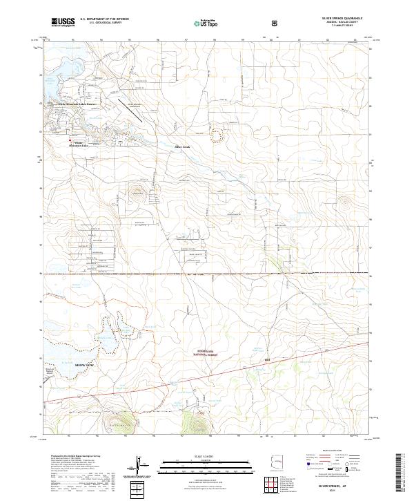
2021 Map of Silver Springs
USGS Topo · Published 2021About this map
White Mountain Lakes Estates and the adjacent White Mountain Lake define the northern landscape of this Navajo County quadrangle. The area showcases a transition from residential developments and leisure-oriented features like the White Mountain Lake Airport and The Forebay to the more open, high-desert terrain of the Sitgreaves National Forest. The map captures a sophisticated network of local roads such as Mazatzal St and Airport Blvd that weave through these communities, contrasted by the rugged topography of Rocky Arroyo and Cooley Knoll.
Find a feature on this map
111 named features on this map. Tap any name to fly to it.
Don’t see what you’re looking for? This feature index may not catch every label — zoom into the map to look around manually.
Map Details
Editions of this 2021 Silver Springs Map
This is the sole edition of this map. No revisions or reprints were ever made.
Other maps of this area

1886 · St Johns
USGS Topo · 1:250,000

1886 · Holbrook
USGS Topo · 1:250,000

1892 · St Johns
USGS Topo · 1:250,000

1893 · Holbrook
USGS Topo · 1:250,000

1954 · Holbrook
USGS Topo · 1:250,000

1954 · Saint Johns
USGS Topo · 1:250,000

1957 · Holbrook
USGS Topo · 1:250,000

1957 · Saint Johns
USGS Topo · 1:250,000

1958 · Saint Johns
USGS Topo · 1:250,000

1958 · Holbrook
USGS Topo · 1:250,000