2022 Map of Silverdale
USGS Topo · Published 2022About this map
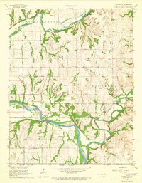
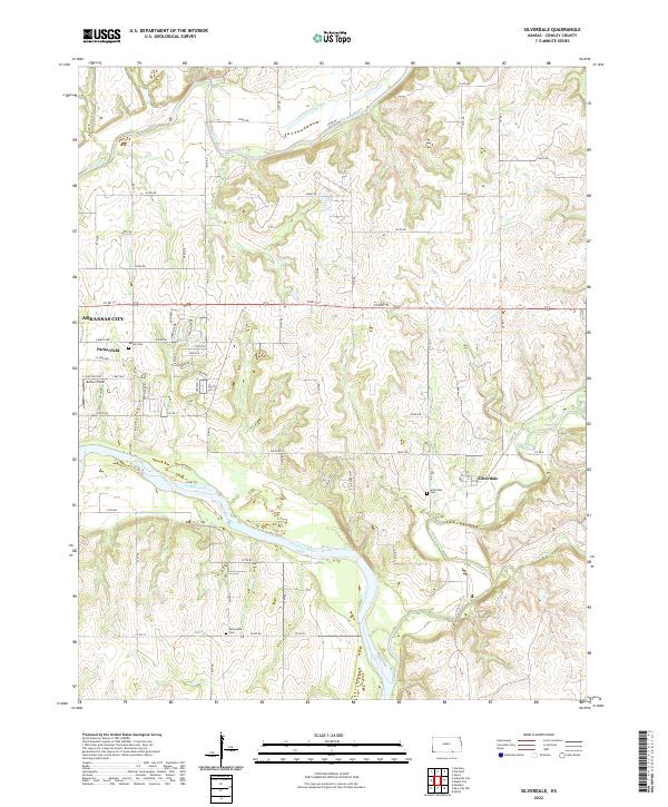
The confluence of the Walnut River and the Arkansas River defines this landscape in southern Cowley County, just east of Arkansas City. The terrain is marked by the winding path of Grouse Creek and Otter Cr as they cut through the limestone uplands of the Flint Hills region. The small community of Silverdale sits near the eastern edge of the map, while Parkerfield occupies a prominent position near the river bend to the west. This 2022 survey detail provides essential geographic context for genealogists tracing family roots near Parker Cem, Silverdale Cem, or Springside Cem. The network of section line roads, including Co Rd 12 and Co Rd 22, links these dispersed rural settlements and cemeteries. In addition to the primary river systems, smaller features like Lake Wynds and the local airstrip at Murison Field reflect the modern agricultural and residential character of the area.
Find a feature on this map
65 named features on this map. Tap any name to fly to it.
Don’t see what you’re looking for? This feature index may not catch every label — zoom into the map to look around manually.
Map Details
Editions of this 2022 Silverdale Map
This is the sole edition of this map. No revisions or reprints were ever made.