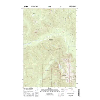
2017 Map of Silverton
USGS Topo · Published 2017About this map
Silverton lies at the heart of this mountain landscape, situated along the South Fork Stillaguamish River where steep valleys converge. The 2017 survey reveals the division of the high country between the Mount Baker National Forest and the Snoqualmie National Forest, reflecting a geography defined by jagged peaks and alpine basins. Significant vertical relief is marked by landmarks such as Big Four Mtn and Devils Peak, while the interior drainage is shaped by Silver Gulch and Marble Gulch. High-elevation water bodies like Copper Lake and Coal Lake are accessible only via forest development roads, including Nat For Dev Rd 4052. This modern data illustrates how the former mining district has transitioned into a landscape primarily managed for conservation and recreation, while retaining the historical footprints of routes like Williamson Creek Rd.
Find a feature on this map
41 named features on this map. Tap any name to fly to it.
Don’t see what you’re looking for? This feature index may not catch every label — zoom into the map to look around manually.
Map Details
Editions of this 2017 Silverton Map
This is the sole edition of this map. No revisions or reprints were ever made.
Other maps of this area

1899 · Glacier Peak
USGS Topo · 1:125,000

1899 · Stillaguamish
USGS Topo · 1:125,000

1901 · Glacier Peak
USGS Topo · 1:125,000

1901 · Stilaguamish
USGS Topo · 1:125,000

1902 · Skykomish
USGS Topo · 1:125,000

1905 · Skykomish
USGS Topo · 1:125,000

1921 · Sultan
USGS Topo · 1:125,000

1923 · Sultan
USGS Topo · 1:125,000

1955 · Concrete
USGS Topo · 1:250,000

1957 · Silverton
USGS Topo · 1:62,500