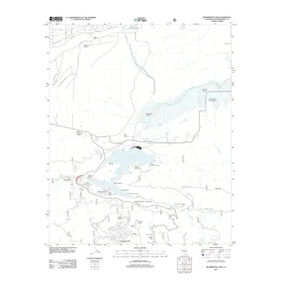
2012 Map of Silverwood Lake
USGS Topo · Published 2012About this map
Silverwood Lake serves as the central focal point of this San Bernardino County landscape, where the Governor Edmund G Brown California Aqueduct feeds into the reservoir system. The map documents a transition from the developing residential streets of Lugo and the Hesperia Airport in the north to the mountainous terrain of the San Bernardino National Forest in the south. In the rugged canyons and ridges, landmarks such as Pillars of God, Jamajab Point, and Pilot Rock stand alongside established mountain communities like Cedarpines Park. This 2012 survey illustrates a landscape heavily utilized for recreation and water management, featuring numerous campsites and day-use areas including Mesa Campground, Camp Seeley, and the San Bernardino County Regional Park Campground near Summit Valley.
Find a feature on this map
66 named features on this map. Tap any name to fly to it.
Don’t see what you’re looking for? This feature index may not catch every label — zoom into the map to look around manually.
Map Details
Editions of this 2012 Silverwood Lake Map
This is the sole edition of this map. No revisions or reprints were ever made.
Other maps of this area

1896 · San Bernardino
USGS Topo · 1:62,500

1898 · San Bernardino
USGS Topo · 1:62,500

1899 · Redlands
USGS Topo · 1:62,500

1901 · Southern California Sheet No. 1
USGS Topo · 1:250,000

1901 · San Bernardino
USGS Topo · 1:62,500

1901 · Redlands
USGS Topo · 1:62,500

1902 · Deep Creek
USGS Topo · 1:62,500

1902 · Hesperia
USGS Topo · 1:62,500

1904 · Southern California Sheet No. 1
USGS Topo · 1:250,000

1936 · Devore
USGS Topo · 1:31,680