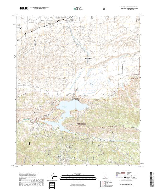
2021 Map of Silverwood Lake
USGS Topo · Published 2021About this map
Silverwood Lake serves as a central hub for water management and recreation in the San Bernardino National Forest, where the Governor Edmund G Brown E Br California Aqueduct feeds into the reservoir. This modern survey shows the transition from the high desert floor of Antelope Valley and Hesperia to the northern reaches of the San Bernardino Mountains. A complex network of trails, including the Pacific Crest National Scenic Trl, Cleghorn Ridge Trl, and Pilot Rock Trl, navigates the steep topography between Horsethief Canyon and Miller Canyon. To the south, the settlement of Cedarpines Park is situated near Jobs Peak, while the northern portion of the map includes the Lugo area and the Hesperia Airport, reflecting the infrastructure required to support both local transit and massive water conveyance systems.
Find a feature on this map
41 named features on this map. Tap any name to fly to it.
Don’t see what you’re looking for? This feature index may not catch every label — zoom into the map to look around manually.
Map Details
Editions of this 2021 Silverwood Lake Map
This is the sole edition of this map. No revisions or reprints were ever made.
Other maps of this area

1896 · San Bernardino
USGS Topo · 1:62,500

1898 · San Bernardino
USGS Topo · 1:62,500

1899 · Redlands
USGS Topo · 1:62,500

1901 · Southern California Sheet No. 1
USGS Topo · 1:250,000

1901 · San Bernardino
USGS Topo · 1:62,500

1901 · Redlands
USGS Topo · 1:62,500

1902 · Deep Creek
USGS Topo · 1:62,500

1902 · Hesperia
USGS Topo · 1:62,500

1904 · Southern California Sheet No. 1
USGS Topo · 1:250,000

1936 · Devore
USGS Topo · 1:31,680