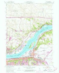
1953 Map of Silvis
USGS Topo · Published 1977About this map
The Mississippi River serves as the central artery of this industrial and residential landscape, separating Scott and Rock Island Counties at the heart of the Quad Cities area. Along the Illinois bank, the extensive grounds of the East Moline State Hospital and its associated State Hospital Cemetery occupy a prominent position near Hampton. The river's reach is defined by complex engineering and natural landforms, including Lock and Dam No 14, the Le Claire Canal, and the large Campbells Island. Heavy industry is a visible driver of growth during this era, evidenced by the Aluminum plant and the Riverside Power Plant on the Iowa side. This mid-century survey, updated in the 1970s, documents the expansion of Silvis, East Moline, and Bettendorf as residential developments and infrastructure like Interstate 80 begin to reshape the Mississippi's historic riverfront and bluffs.
Find a feature on this map
63 named features on this map. Tap any name to fly to it.
Don’t see what you’re looking for? This feature index may not catch every label — zoom into the map to look around manually.
Map Details
Editions of this 1953 Silvis Map
3 editions found

Other maps of this area

1891 · Davenport
USGS Topo · 1:62,500

1892 · Leclaire
USGS Topo · 1:62,500

1893 · Leclaire
USGS Topo · 1:62,500

1894 · Davenport
USGS Topo · 1:62,500

1899 · Clinton
USGS Topo · 1:125,000

1901 · Rock Island
USGS Topo · 1:125,000

1910 · Rock Island
USGS Topo · 1:125,000

1912 · Milan
USGS Topo · 1:62,500

1937 · Orion
USGS Topo · 1:62,500

1944 · Milan
USGS Topo · 1:62,500