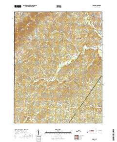
2019 Map of Simeon
USGS Topo · Published 2019About this map
The rolling hills of Carters Mtn and Patterson Mtn dominate the topography of this central Virginia corridor, where rural life is anchored by family-named landholdings and small crossroads communities. Small settlements like Simeon, Overton, and Woodridge are scattered across the landscape, connected by winding routes such as Scottsville Rd and Jefferson Mill Rd. A dense network of creek systems, including Buck Island Creek and its many branches, carves through the terrain toward the Rivanna River in the northeast. This area preserves a high concentration of small burial grounds, from Ash Lawn Cem to Slate Hill Cem, which reflect the long-standing genealogical roots of local families. The southern portion of the sheet reveals the border between Albemarle Co and Fluvanna Co, marked by the presence of Fluvanna Ruritan Lake and the drainage of Turkey Run.
Find a feature on this map
100 named features on this map. Tap any name to fly to it.
Don’t see what you’re looking for? This feature index may not catch every label — zoom into the map to look around manually.
Map Details
Editions of this 2019 Simeon Map
This is the sole edition of this map. No revisions or reprints were ever made.
Other maps of this area

1891 · Palmyra
USGS Topo · 1:125,000

1892 · Buckingham
USGS Topo · 1:125,000

1892 · Gordonsville
USGS Topo · 1:125,000

1892 · Harrisonburg
USGS Topo · 1:125,000

1895 · Palmyra
USGS Topo · 1:125,000

1897 · Palmyra
USGS Topo · 1:125,000

1929 · Covesville
USGS Topo · 1:62,500

1931 · University
USGS Topo · 1:62,500

1935 · Charlottesville
USGS Topo · 1:62,500

1935 · Charlottesville And Vicinity
USGS Topo · 1:31,680