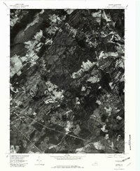
1979 Map of Simeon
USGS Topo · Published 1982About this map
Agricultural lands and wooded ridges define this 1979 orthophotomap of the Albemarle countryside, showing the landscape as it appeared in the late 1970s. The photographic imagery, captured by the Geological Survey in cooperation with the Soil Conservation Service, reveals a pattern of cleared fields and timbered tracts surrounding the rural settlements of Overton and Blenheim. The Rivanna River cuts through the northern portion of the quadrangle, while the southern reaches are drained by Buck Island Creek and Briery Creek.
Find a feature on this map
6 named features on this map. Tap any name to fly to it.
Don’t see what you’re looking for? This feature index may not catch every label — zoom into the map to look around manually.
Map Details
Editions of this 1979 Simeon Map
This is the sole edition of this map. No revisions or reprints were ever made.
Other maps of this area

1891 · Palmyra
USGS Topo · 1:125,000

1892 · Buckingham
USGS Topo · 1:125,000

1892 · Gordonsville
USGS Topo · 1:125,000

1892 · Harrisonburg
USGS Topo · 1:125,000

1895 · Palmyra
USGS Topo · 1:125,000

1897 · Palmyra
USGS Topo · 1:125,000

1929 · Covesville
USGS Topo · 1:62,500

1931 · University
USGS Topo · 1:62,500

1935 · Charlottesville
USGS Topo · 1:62,500

1935 · Charlottesville And Vicinity
USGS Topo · 1:31,680