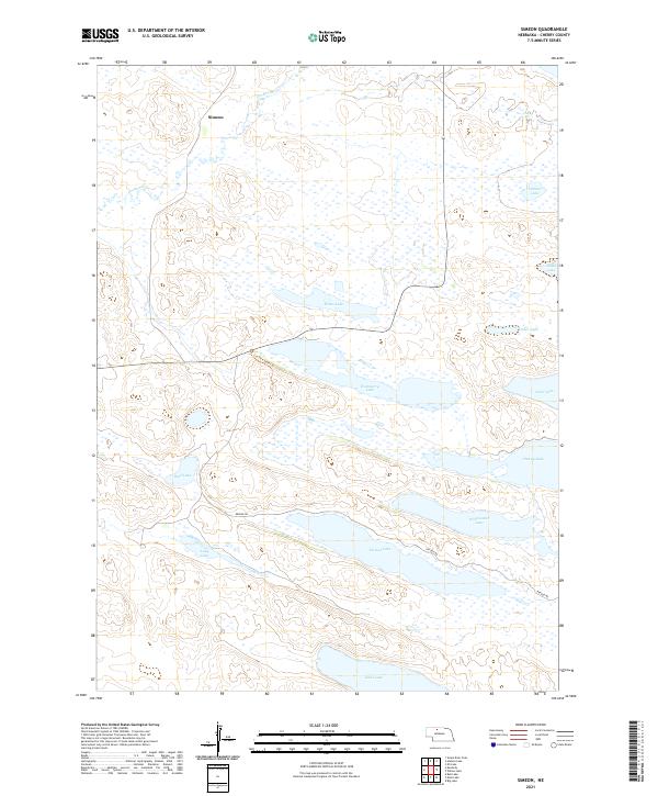
2021 Map of Simeon
USGS Topo · Published 2021About this map
Simeon sits within a landscape defined by an extensive system of alkaline and freshwater lakes in the heart of the Nebraska Sandhills. This 2021 survey shows a complex wetland environment where large bodies of water like Pelican Lake, Whitewater Lake, and Watts Lake dominate the terrain. The presence of Refuge Rd and the Ccc Fire Tower Trl indicates the area's significance for conservation and monitoring. Unlike many agricultural regions, the land here is shaped by the natural hydrology of the dunes, with Gordon Cr moving through the northern reaches. The map details a network of lakes including Dads Lake, Hackberry Lake, and Duck Lake, which together form a critical habitat and a distinct geological profile characteristic of the Cherry County interior. The township and range lines, such as t30n r29w, provide the structural grid for this predominantly natural expanse.
Find a feature on this map
22 named features on this map. Tap any name to fly to it.
Don’t see what you’re looking for? This feature index may not catch every label — zoom into the map to look around manually.
Map Details
Editions of this 2021 Simeon Map
This is the sole edition of this map. No revisions or reprints were ever made.
Other maps of this area

1950 · Simeon
USGS Topo · 1:62,500

1950 · Kennedy
USGS Topo · 1:62,500

1951 · Bull Lake
USGS Topo · 1:62,500

1951 · Brownlee
USGS Topo · 1:62,500

1957 · Valentine
USGS Topo · 1:250,000

1959 · Valentine
USGS Topo · 1:250,000

1985 · Goose Creek
USGS Topo · 1:100,000

1985 · Valentine
USGS Topo · 1:100,000
1985 · Snake River Falls
USGS Topo · 1:24,000
1985 · Kennedy
USGS Topo · 1:24,000