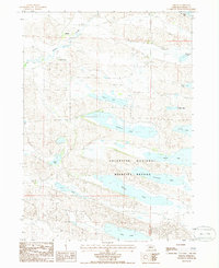
1985 Map of Simeon
USGS Topo · Published 1986About this map
Valentine National Wildlife Refuge dominates this section of the Nebraska Sandhills, preserving a complex system of freshwater marshes and lakes. The landscape is defined by the high concentration of named water bodies, including Pelican Lake, Hackberry Lake, and Watts Lake, which create a critical habitat for migratory birds and local wildlife. These shallow lakes are interconnected by a terrain of undulating dunes and low meadows, where small landmarks like a Boat Ramp on Duck Lake and Dewey Lake indicate the area's use for recreation and conservation.
Find a feature on this map
18 named features on this map. Tap any name to fly to it.
Don’t see what you’re looking for? This feature index may not catch every label — zoom into the map to look around manually.
Map Details
Editions of this 1985 Simeon Map
This is the sole edition of this map. No revisions or reprints were ever made.
Other maps of this area

1950 · Simeon
USGS Topo · 1:62,500

1950 · Kennedy
USGS Topo · 1:62,500

1951 · Bull Lake
USGS Topo · 1:62,500

1951 · Brownlee
USGS Topo · 1:62,500

1957 · Valentine
USGS Topo · 1:250,000

1959 · Valentine
USGS Topo · 1:250,000

1985 · Goose Creek
USGS Topo · 1:100,000

1985 · Valentine
USGS Topo · 1:100,000
1985 · Snake River Falls
USGS Topo · 1:24,000
1985 · Kennedy
USGS Topo · 1:24,000