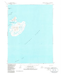
1963 Map of Simeonof Island D-1
USGS Topo · Published 1985About this map
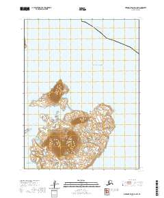
Simeonof Island dominates this 1963 survey of the remote Shumagin Islands, situated within the cold waters of the Pacific Ocean. This isolated landmass, characterized by its protective Simeonof Harbor on the northwest coast, is part of the extensive Alaska Maritime National Wildlife Refuge. The surrounding hydrography, including the Twelve Fathom Strait and the vast Shumagin Bank, highlights the treacherous maritime environment of the Aleutians East region. To the northwest, the map identifies Little Koniuji Island and the smaller Murie Islets, showing the scattered nature of these volcanic outcroppings. This topographical record, which underwent minor revisions through 1984, documents the shoreline and elevation contours of a landscape managed for conservation, where human settlement is absent in favor of protected habitat for coastal wildlife.
Find a feature on this map
8 named features on this map. Tap any name to fly to it.
Don’t see what you’re looking for? This feature index may not catch every label — zoom into the map to look around manually.
Map Details
Editions of this 1963 Simeonof Island D-1 Map
2 editions found
Other maps of this area

1951 · Stepovak Bay
USGS Topo · 1:250,000
1963 · Simeonof Island D-2
USGS Topo · 1:63,360

1963 · Simeonof Island D-1
USGS Topo · 1:63,360
1963 · Stepovak Bay A-5
USGS Topo · 1:63,360

1963 · Simeonof Island
USGS Topo · 1:250,000

1963 · Stepovak Bay
USGS Topo · 1:250,000

1967 · Simeonof Island
USGS Topo · 1:250,000

1969 · Stepovak Bay
USGS Topo · 1:250,000
2020 · Simeonof Island D-2 NE
USGS Topo · 1:25,000
2020 · Simeonof Island D-1 NW
USGS Topo · 1:25,000