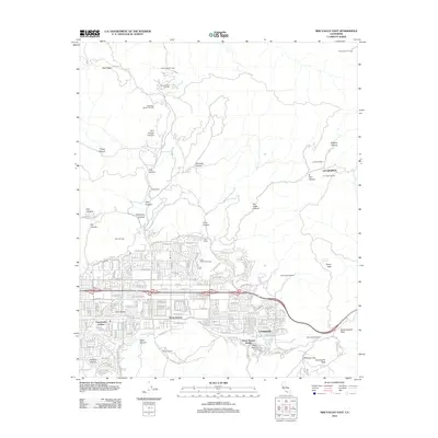
2012 Map of Simi Valley East
USGS Topo · Published 2012About this map
Arroyo Simi flows through the heart of the valley, anchoring the residential and commercial growth of Simi Valley and Santa Susana. The landscape is a distinct blend of dense suburban development and active industrial extraction, with several major energy sites including the Tapo Ridge Oil Field and the Simi Oil Field dotting the northern ridges. The eastern gateway to the valley is defined by the steep terrain of the Santa Susana Pass, a historic transportation corridor where the Santa Susana Tunnel pierces the hillside to connect the region.
Find a feature on this map
88 named features on this map. Tap any name to fly to it.
Don’t see what you’re looking for? This feature index may not catch every label — zoom into the map to look around manually.
Map Details
Editions of this 2012 Simi Valley East Map
This is the sole edition of this map. No revisions or reprints were ever made.
Other maps of this area

1900 · Triunfo Pass
USGS Topo · 1:62,500

1900 · Piru
USGS Topo · 1:62,500

1903 · Calabasas
USGS Topo · 1:62,500

1903 · Camulos
USGS Topo · 1:125,000

1903 · Santa Susana
USGS Topo · 1:62,500

1921 · Piru
USGS Topo · 1:62,500

1921 · Triunfo Pass
USGS Topo · 1:62,500

1925 · Chatsworth
USGS Topo · 1:24,000

1927 · Chatsworth
USGS Topo · 1:24,000
1929 · Chatsworth
USGS Topo · 1:24,000
Featured Places
- Los Angeles, CA
- Simi Valley, CA
- Unincorporated Chatsworth, CA
- Santa Susana, CA
- Alamo Villas, Simi Valley