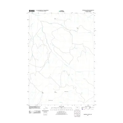
2011 Map of Simmons Canyon
USGS Topo · Published 2011About this map
Moss Ranch stands as a focal point in this 2011 survey of the northern Big Horn Mountains, where water management and seasonal livestock grazing define the landscape. This high-altitude drainage network is anchored by Porcupine Creek and Deer Creek, with numerous named water sources such as Godes Springs and Dipping Vat Springs indicating the practical needs of ranching in this arid environment. The southern portion of the map is dominated by a series of rugged terrain features, including Little Mountain and the deep incisions of Vopats Canyon and Simmons Canyon. The Presence of High Ditch further highlights the historical efforts to divert water for agricultural use across this remote Wyoming territory.
Find a feature on this map
20 named features on this map. Tap any name to fly to it.
Don’t see what you’re looking for? This feature index may not catch every label — zoom into the map to look around manually.
Map Details
Editions of this 2011 Simmons Canyon Map
This is the sole edition of this map. No revisions or reprints were ever made.
Other maps of this area

1894 · St. Xavier
USGS Topo · 1:125,000

1898 · Bald Mountain
USGS Topo · 1:125,000

1901 · St. Xavier
USGS Topo · 1:125,000

1901 · Bald Mountain
USGS Topo · 1:125,000

1954 · Billings
USGS Topo · 1:250,000

1954 · Hardin
USGS Topo · 1:250,000

1955 · Cody
USGS Topo · 1:250,000

1955 · Sheridan
USGS Topo · 1:250,000

1957 · Hardin
USGS Topo · 1:250,000

1957 · Billings
USGS Topo · 1:250,000