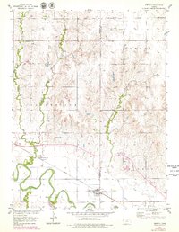
1953 Map of Simpson
USGS Topo · Published 1979About this map
Solomon River meanders across the southern portion of this landscape, defining the agricultural and transport corridors of north-central Kansas during the mid-to-late 20th century. The settlement of Simpson sits near the eastern boundary of Mitchell County, while the town of Asherville is positioned further west, both linked by the Union Pacific railroad line that follows the river valley. The topography is marked by several drainage systems, including West Asher Creek, East Asher Creek, and Lost Creek, which carve through the townships of Lulu, Summit, and Logan.
Find a feature on this map
21 named features on this map. Tap any name to fly to it.
Don’t see what you’re looking for? This feature index may not catch every label — zoom into the map to look around manually.
Map Details
Editions of this 1953 Simpson Map
2 editions found
Other maps of this area

1892 · Concordia
USGS Topo · 1:125,000

1892 · Minneapolis
USGS Topo · 1:125,000

1894 · Mankato
USGS Topo · 1:125,000

1894 · Beloit
USGS Topo · 1:125,000

1952 · Glasco SW
USGS Topo · 1:24,000

1952 · Glasco
USGS Topo · 1:24,000

1953 · Glasco NE
USGS Topo · 1:24,000

1953 · Simpson
USGS Topo · 1:24,000

1953 · Beloit
USGS Topo · 1:24,000

1955 · Manhattan
USGS Topo · 1:250,000