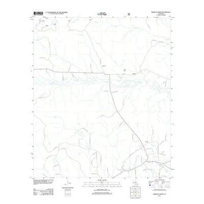
2012 Map of Simpson North
USGS Topo · Published 2012About this map
Hutton sits at the center of this rural Louisiana landscape, where the local road network connects small family-named landmarks and historical burial grounds. The area is defined by a dense web of watercourses, including Little Bayou Pierre in the north and the winding path of Comrade Cr south of town. This 2012 survey details the parish road system that provides access to the Robinson Cem, Ballview Cem, and Welcome Cem, which serve as vital points of reference for genealogists and local historians. The terrain is deeply carved by numerous branches and creeks, such as Menace Cr and Mill Cr, illustrating a landscape where drainage and elevation have long dictated the placement of homesteads and timber access routes. The prevalence of family names on roads like Albritten Rd and Roger Parker Rd suggests a community where landownership and ancestry remain closely tied to the geography.
Find a feature on this map
71 named features on this map. Tap any name to fly to it.
Don’t see what you’re looking for? This feature index may not catch every label — zoom into the map to look around manually.
Map Details
Editions of this 2012 Simpson North Map
This is the sole edition of this map. No revisions or reprints were ever made.
Other maps of this area

1937 · Chopin SW
USGS Topo · 1:31,680

1937 · Chopin NW
USGS Topo · 1:31,680

1941 · Slagle
USGS Topo · 1:62,500

1942 · Kisatchie
USGS Topo · 1:62,500

1943 · Leander
USGS Topo · 1:62,500

1943 · Kisatchie
USGS Topo · 1:62,500

1944 · Chopin
USGS Topo · 1:62,500

1944 · Slagle
USGS Topo · 1:62,500

1948 · Chopin
USGS Topo · 1:62,500

1953 · Alexandria
USGS Topo · 1:250,000