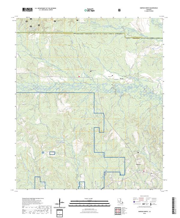
2024 Map of Simpson North
USGS Topo · Published 2024About this map
Hutton and Simpson anchor the southern reaches of this landscape, situated at a junction where timberlands meet large-scale military training grounds. Much of the northern terrain is occupied by the Kisatchie National Forest, while the southwestern section is dominated by the Peason Ridge Training Area and a portion of Fort Polk. The area is characterized by a dense network of watercourses, including the westward-flowing Comrade Creek and its various tributaries like Buck Branch and Brush Creek.
Find a feature on this map
65 named features on this map. Tap any name to fly to it.
Don’t see what you’re looking for? This feature index may not catch every label — zoom into the map to look around manually.
Map Details
Editions of this 2024 Simpson North Map
This is the sole edition of this map. No revisions or reprints were ever made.
Other maps of this area

1937 · Chopin SW
USGS Topo · 1:31,680

1937 · Chopin NW
USGS Topo · 1:31,680

1941 · Slagle
USGS Topo · 1:62,500

1942 · Kisatchie
USGS Topo · 1:62,500

1943 · Leander
USGS Topo · 1:62,500

1943 · Kisatchie
USGS Topo · 1:62,500

1944 · Chopin
USGS Topo · 1:62,500

1944 · Slagle
USGS Topo · 1:62,500

1948 · Chopin
USGS Topo · 1:62,500

1953 · Alexandria
USGS Topo · 1:250,000