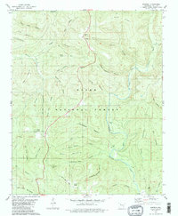
1980 Map of Simpson
USGS Topo · Published 1980About this map
Simpson sits as a central settlement within the deep drainages and ridges of the Ozark National Forest in Pope County. The landscape is defined by the North Fork Illinois Bayou and its numerous tributaries, which have carved an intricate network of hollows such as Stave Mill Hollow and Mose Freeman Hollow. This 1980 edit reflects a region where the rugged terrain dictated the placement of small communities and family-named landmarks.
Find a feature on this map
48 named features on this map. Tap any name to fly to it.
Don’t see what you’re looking for? This feature index may not catch every label — zoom into the map to look around manually.
Map Details
Editions of this 1980 Simpson Map
2 editions found
Other maps of this area

1879 · Washington
USGS Topo · 1:62,500

1887 · Smyrna
USGS Topo · 1:62,500

1888 · Dardanelle #1
USGS Topo · 1:62,500

1889 · Treat
USGS Topo · 1:62,500

1889 · Marshall #3
USGS Topo · 1:62,500

1890 · Dardanelle
USGS Topo · 1:125,000

1892 · Marshall
USGS Topo · 1:125,000

1892 · Morrillton
USGS Topo · 1:125,000

1894 · Morrillton
USGS Topo · 1:125,000

1894 · Marshall
USGS Topo · 1:125,000