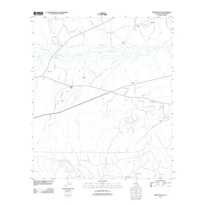
2012 Map of Simpson South
USGS Topo · Published 2012About this map
The Calcasieu River and its dense network of tributaries, including Big Slough and Mims Cr, define the landscape of northern Vernon Parish. This 2012 survey illustrates the transition from the upland settlements of Simpson and Walnut Hill down into the northern reaches of the Fort Polk military reservation. The geography is marked by a legacy of family and community landmarks, such as Glass Window Cem and Mount Pleasant Cem, which anchor the small rural clusters at Mayo and Hicks. Moving south toward the military lands, the terrain becomes increasingly defined by drainage basins like Flactaw Cr and Brushy Cr. The mapping of Numerous parish roads and loop tracks, such as Zagar Loop and B Owens Loop, provides a detailed view of the local transportation network serving these timbered and rural residential areas.
Find a feature on this map
86 named features on this map. Tap any name to fly to it.
Don’t see what you’re looking for? This feature index may not catch every label — zoom into the map to look around manually.
Map Details
Editions of this 2012 Simpson South Map
This is the sole edition of this map. No revisions or reprints were ever made.
Other maps of this area

1937 · Chopin SW
USGS Topo · 1:31,680

1941 · Slagle
USGS Topo · 1:62,500

1942 · Kisatchie
USGS Topo · 1:62,500

1943 · Leander
USGS Topo · 1:62,500

1943 · Kisatchie
USGS Topo · 1:62,500

1944 · Chopin
USGS Topo · 1:62,500

1944 · Slagle
USGS Topo · 1:62,500

1948 · Chopin
USGS Topo · 1:62,500

1953 · Alexandria
USGS Topo · 1:250,000
1954 · Birds Creek
USGS Topo · 1:24,000