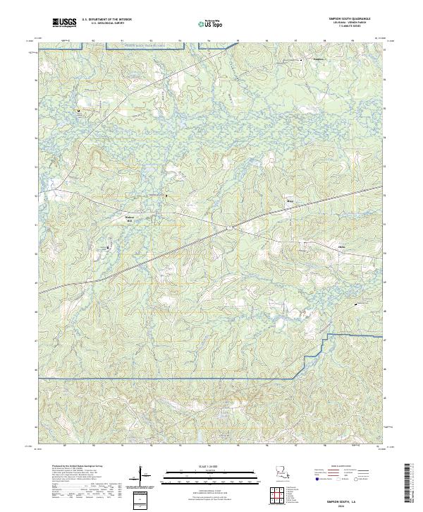
2024 Map of Simpson South
USGS Topo · Published 2024About this map
The Calcasieu River meanders through this portion of Vernon Parish, creating a complex drainage network of bayous and creeks including Big Slough and Cypress Creek. The landscape is defined by the intersection of rural life and military operations, as the southern reaches are dominated by the Fort Polk reservation, including Artillery Lake and the Jason Ridge Training Area. This military presence contrasts with the small, scattered settlements of Simpson, Mayo, and Walnut Hill that have long anchored the local community. Genealogists will find significant value in the numerous burial sites documented across the terrain, such as Union Grove Cem and Glass Window Cem. The intricate road network, consisting of parish roads and loops like Zagar Loop, reveals how these disparate hamlets and military training grounds are stitched together amidst the wet bottomlands of Spring Branch and Cowpen Gully.
Find a feature on this map
68 named features on this map. Tap any name to fly to it.
Don’t see what you’re looking for? This feature index may not catch every label — zoom into the map to look around manually.
Map Details
Editions of this 2024 Simpson South Map
This is the sole edition of this map. No revisions or reprints were ever made.
Other maps of this area

1937 · Chopin SW
USGS Topo · 1:31,680

1941 · Slagle
USGS Topo · 1:62,500

1942 · Kisatchie
USGS Topo · 1:62,500

1943 · Leander
USGS Topo · 1:62,500

1943 · Kisatchie
USGS Topo · 1:62,500

1944 · Chopin
USGS Topo · 1:62,500

1944 · Slagle
USGS Topo · 1:62,500

1948 · Chopin
USGS Topo · 1:62,500

1953 · Alexandria
USGS Topo · 1:250,000
1954 · Birds Creek
USGS Topo · 1:24,000