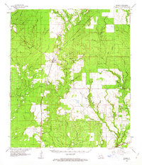
1961 Map of Singer
USGS Topo · Published 1963About this map
Beckwith Creek and its complex network of tributaries like Wildcat Branch and Poteu Branch define this landscape in the early 1960s. The Southern Kansas City rail line serves as the primary north-south spine for the region, connecting the rural communities of Singer, Juanita, and Oretta. This era shows a transition toward heavy industrial land use, marked by the extensive Longville Oil Field and the Cowpen Creek Oil and Gas Field in the southeastern quadrant.
Find a feature on this map
68 named features on this map. Tap any name to fly to it.
Don’t see what you’re looking for? This feature index may not catch every label — zoom into the map to look around manually.
Map Details
Editions of this 1961 Singer Map
2 editions found
Other maps of this area

1935 · Gordon
USGS Topo · 1:31,680

1935 · Gaytine
USGS Topo · 1:31,680

1935 · Longville
USGS Topo · 1:31,680

1946 · Merryville
USGS Topo · 1:31,680

1947 · Singer
USGS Topo · 1:31,680

1947 · Gaytine
USGS Topo · 1:31,680

1947 · Pujo
USGS Topo · 1:31,680

1947 · DeQuincy
USGS Topo · 1:31,680

1947 · Oretta
USGS Topo · 1:31,680

1947 · DeRidder
USGS Topo · 1:31,680