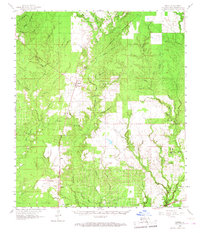
1961 Map of Singer
USGS Topo · Published 1968About this map
Southern Kansas City railroad tracks anchor the landscape of western Beauregard Parish, linking small settlements like Singer and Juanita in the early 1960s. The region is characterized by a dense network of watercourses, where Beckwith Creek and Bear Head Creek drain the timberlands and occasional clearings. This survey provides a record of the community's spiritual and social hubs, from Holly Grove Ch in the north to the Louisiana Correctional Institute near Oretta. Toward the southeast, industrial activity is evident at the Longville Oil and Gas Field, marked by numerous oil wells scattered through the piney woods. Genealogists will find value in the placement of rural burial grounds such as Newlin Cem and Oretta Cem, which document the family names that established these backcountry Louisiana townships.
Find a feature on this map
63 named features on this map. Tap any name to fly to it.
Don’t see what you’re looking for? This feature index may not catch every label — zoom into the map to look around manually.
Map Details
Editions of this 1961 Singer Map
2 editions found
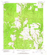
Other maps of this area

1935 · Gordon
USGS Topo · 1:31,680

1935 · Gaytine
USGS Topo · 1:31,680

1935 · Longville
USGS Topo · 1:31,680

1946 · Merryville
USGS Topo · 1:31,680

1947 · Singer
USGS Topo · 1:31,680

1947 · Gaytine
USGS Topo · 1:31,680

1947 · Pujo
USGS Topo · 1:31,680

1947 · DeQuincy
USGS Topo · 1:31,680

1947 · Oretta
USGS Topo · 1:31,680

1947 · DeRidder
USGS Topo · 1:31,680