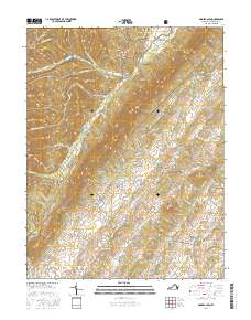
2016 Map of Singers Glen
USGS Topo · Published 2016About this map
Singers Glen serves as the focal point of this Virginia landscape, where the Shenandoah Valley meets the eastern slopes of the North Mountain range. The settlement pattern follows the intricate drainage systems of Muddy Cr and Linville Cr, with small communities like Green Mount and Sparkling Springs established along these valley floors. The presence of Stultz Mill and the Green Mount Cem suggests a long-standing rural economy tied to the land and local industry. To the west, the terrain rises sharply into the George Washington National Forest, where steep ridges like Buck Lick Mtn and Gauley Ridge dominate the horizon. Historical transit routes through the mountains are marked by features such as Hopkins Gap and Thompson Gap, which historically connected these valley settlements to the river systems of the west.
Find a feature on this map
98 named features on this map. Tap any name to fly to it.
Don’t see what you’re looking for? This feature index may not catch every label — zoom into the map to look around manually.
Map Details
Editions of this 2016 Singers Glen Map
This is the sole edition of this map. No revisions or reprints were ever made.
Other maps of this area

1892 · Franklin
USGS Topo · 1:125,000

1892 · Woodstock
USGS Topo · 1:125,000

1892 · Harrisonburg
USGS Topo · 1:125,000

1894 · Staunton
USGS Topo · 1:125,000

1896 · Franklin
USGS Topo · 1:125,000

1922 · Fort Seybert
USGS Topo · 1:48,000

1924 · Fort Seybert
USGS Topo · 1:62,500

1941 · Harrisonburg
USGS Topo · 1:62,500

1943 · Harrisonburg
USGS Topo · 1:62,500

1944 · Parnassus
USGS Topo · 1:62,500