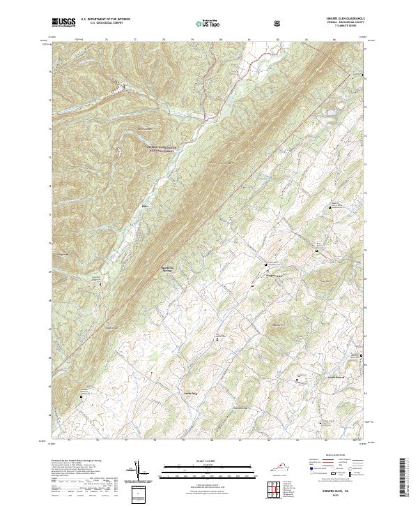
2022 Map of Singers Glen
USGS Topo · Published 2022About this map
Singers Glen serves as the focal point of this Rockingham County landscape, where the foothills of the Blue Ridge meet the established farmlands of the Shenandoah Valley. The terrain is defined by the sharp rise of Little North Mtn and Buck Lick Mtn within the George Washington National Forest, creating a natural barrier that directs settlement toward the fertile lowlands of the Shoemaker River and Muddy Creek. The region is notably rich in denominational history, as evidenced by numerous rural burial grounds such as the Gospel Hill Mennonite Church Cem and the Saint John Lutheran Cem. The industrial past of the area is represented by Stultz Mill, located along the winding waters of Muddy Creek, while the presence of Sparkling Springs suggests the importance of natural water sources to the early development of this rural Virginia community.
Find a feature on this map
113 named features on this map. Tap any name to fly to it.
Don’t see what you’re looking for? This feature index may not catch every label — zoom into the map to look around manually.
Map Details
Editions of this 2022 Singers Glen Map
This is the sole edition of this map. No revisions or reprints were ever made.
Other maps of this area

1892 · Franklin
USGS Topo · 1:125,000

1892 · Woodstock
USGS Topo · 1:125,000

1892 · Harrisonburg
USGS Topo · 1:125,000

1894 · Staunton
USGS Topo · 1:125,000

1896 · Franklin
USGS Topo · 1:125,000

1922 · Fort Seybert
USGS Topo · 1:48,000

1924 · Fort Seybert
USGS Topo · 1:62,500

1941 · Harrisonburg
USGS Topo · 1:62,500

1943 · Harrisonburg
USGS Topo · 1:62,500

1944 · Parnassus
USGS Topo · 1:62,500