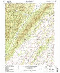
1994 Map of Singers Glen
USGS Topo · Published 1997About this map
Singers Glen serves as the central hub for this corner of Rockingham County, situated beneath the imposing ridge of North Mountain. The landscape is defined by the sharp contrast between the densely wooded heights of the George Washington National Forest and the fertile valley floors drained by the Shoemaker River and Linville Creek. To the west, the steep terrain of Cross Mtn and Buck Lick Mtn is marked by remote stream runs like Black Lick Run and State Lick Run.
Find a feature on this map
43 named features on this map. Tap any name to fly to it.
Don’t see what you’re looking for? This feature index may not catch every label — zoom into the map to look around manually.
Map Details
Editions of this 1994 Singers Glen Map
This is the sole edition of this map. No revisions or reprints were ever made.
Other maps of this area

1892 · Franklin
USGS Topo · 1:125,000

1892 · Woodstock
USGS Topo · 1:125,000

1892 · Harrisonburg
USGS Topo · 1:125,000

1894 · Staunton
USGS Topo · 1:125,000

1896 · Franklin
USGS Topo · 1:125,000

1922 · Fort Seybert
USGS Topo · 1:48,000

1924 · Fort Seybert
USGS Topo · 1:62,500

1941 · Harrisonburg
USGS Topo · 1:62,500

1943 · Harrisonburg
USGS Topo · 1:62,500

1944 · Parnassus
USGS Topo · 1:62,500