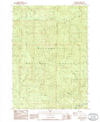
1986 Map of Sinker Mtn
USGS Topo · Published 1986About this map
The Willamette National Forest dominates this mid-1980s landscape, where a dense network of watercourses feeds into the Middle Fork Willamette River. The terrain is defined by prominent elevations such as Alpine Ridge and the distinct peak of Sinker Mtn. Human activity in this timbered region is marked by numerous industrial sites, including a series of Quarry and Borrow Pit locations that indicate ongoing road maintenance and resource extraction within the forest boundaries. Recreational and navigational landmarks like the Elk Camp Shelter, Gold Point, and several Footbridge crossings suggest a landscape managed for both utility and backcountry access. Local nomenclature is particularly evocative, with labels like Nevergo Creek, Puma Creek, and Elephant Rock providing a sense of the region's topographical character. The presence of multiple gates across forest roads reflects the controlled access common in managed federal timberlands during this era.
Find a feature on this map
33 named features on this map. Tap any name to fly to it.
Don’t see what you’re looking for? This feature index may not catch every label — zoom into the map to look around manually.
Map Details
Editions of this 1986 Sinker Mtn Map
This is the sole edition of this map. No revisions or reprints were ever made.
Other maps of this area

1925 · Waldo Lake
USGS Topo · 1:125,000

1934 · Mc Kenzie Bridge
USGS Topo · 1:96,000

1935 · Lowell
USGS Topo · 1:96,000

1940 · Mc Kenzie Bridge
USGS Topo · 1:125,000

1942 · Lowell
USGS Topo · 1:125,000

1951 · Leaburg
USGS Topo · 1:62,500

1953 · Salem
USGS Topo · 1:250,000

1954 · Salem
USGS Topo · 1:250,000

1955 · Hardesty Mtn
USGS Topo · 1:62,500

1955 · Blue River
USGS Topo · 1:62,500