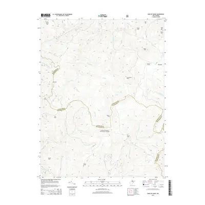
2014 Map of Sinks of Gandy
USGS Topo · Published 2014About this map
The Monongahela National Forest dominates this highland landscape, where the headwaters of several major river systems begin their descent. Central to the map is the Sinks of Gandy, a notable subterranean passage of Gandy Cr that has long drawn interest for its unique hydrology. The settlement of Osceola sits near the northern boundary, serving as a point of reference in an area defined by high ridges and deep drainages. Multiple county lines, including the junction of Pocahontas and Randolph and Pocahontas and Pendleton, traverse the high peaks. The terrain is a complex network of named knobs and mountains, such as Burner Mtn, Yokum Knob, and Little Beech Mtn, which separate the various forks of the Dry Fork, Laurel Fork, and the E Fork Greenbrier River.
Find a feature on this map
47 named features on this map. Tap any name to fly to it.
Don’t see what you’re looking for? This feature index may not catch every label — zoom into the map to look around manually.
Map Details
Editions of this 2014 Sinks of Gandy Map
This is the sole edition of this map. No revisions or reprints were ever made.
Other maps of this area

1889 · Beverly
USGS Topo · 1:125,000

1892 · Beverly
USGS Topo · 1:125,000

1909 · Elkins
USGS Topo · 1:62,500

1922 · Horton
USGS Topo · 1:48,000

1922 · Spruce Knob
USGS Topo · 1:48,000

1922 · Durbin
USGS Topo · 1:48,000

1924 · Durbin
USGS Topo · 1:62,500

1924 · Horton
USGS Topo · 1:62,500

1924 · Spruce Knob
USGS Topo · 1:62,500

1949 · Charlottesville
USGS Topo · 1:250,000