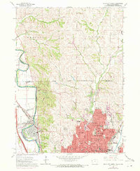
1963 Map of Sioux City North
USGS Topo · Published 1972About this map
The Big Sioux River and the Floyd River define the industrial and civic landscape of this northern Iowa region, where the Sioux City Corporate Boundary meets the hills of Plymouth County. The urban density of Sioux City and the neighboring North Sioux City is set against the natural elevation of Mt Lucia and the sprawling grounds of Stone State Park. This period shows a community deeply invested in education and spiritual life, evidenced by the numerous institutions such as Briar Cliff College, Trinity College, and several parochial schools including Blessed Sacrament Sch and St Boniface Sch.
Find a feature on this map
64 named features on this map. Tap any name to fly to it.
Don’t see what you’re looking for? This feature index may not catch every label — zoom into the map to look around manually.
Map Details
Editions of this 1963 Sioux City North Map
3 editions found
Other maps of this area

1898 · Elk Point
USGS Topo · 1:125,000

1901 · Elk Point
USGS Topo · 1:125,000

1907 · Elk Point
USGS Topo · 1:125,000

1955 · Sioux City
USGS Topo · 1:250,000

1958 · Sioux City
USGS Topo · 1:250,000

1959 · Sioux City
USGS Topo · 1:250,000

1963 · Sioux City South
USGS Topo · 1:24,000

1963 · Sioux City North
USGS Topo · 1:24,000

1963 · Elk Point NE
USGS Topo · 1:24,000

1963 · Jefferson
USGS Topo · 1:24,000