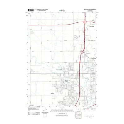
2012 Map of Sioux Falls West
USGS Topo · Published 2012About this map
Skunk Cr and Willow Cr wind through the western expansion of Sioux Falls, illustrating the suburban transition from rural farmland to residential neighborhoods in the early 21st century. The map captures the distinct footprint of Ellis, once a small outlying community, now surrounded by growing residential tracts such as the Webster Grove Addition and West Acres Development. Local history and genealogy are preserved at Berg Cem and Bethel Cem, while the cultural landscape includes the ancient Sherman Park Mounds near the banks of the Big Sioux River.
Find a feature on this map
172 named features on this map. Tap any name to fly to it.
Don’t see what you’re looking for? This feature index may not catch every label — zoom into the map to look around manually.
Map Details
Editions of this 2012 Sioux Falls West Map
This is the sole edition of this map. No revisions or reprints were ever made.
Other maps of this area

1897 · Canton
USGS Topo · 1:125,000

1900 · Canton
USGS Topo · 1:125,000

1955 · Sioux Falls
USGS Topo · 1:250,000

1958 · Sioux Falls
USGS Topo · 1:250,000

1962 · Renner
USGS Topo · 1:24,000

1962 · Harrisburg
USGS Topo · 1:24,000

1962 · Sioux Falls East
USGS Topo · 1:24,000

1962 · Tea
USGS Topo · 1:24,000

1962 · Hartford South
USGS Topo · 1:24,000

1962 · Lennox NW
USGS Topo · 1:24,000