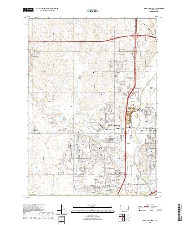
2021 Map of Sioux Falls West
USGS Topo · Published 2021About this map
Sioux Falls spreads westward in this recent survey, showing the dense residential and industrial expansion that characterizes the modern Minnehaha County landscape. The urban grid is defined by major thoroughfares like W Benson Rd and W Madison St, which bridge the gap between the historic core and the smaller settlement of Ellis. This area is a primary transportation and aviation hub for the region, anchored by the expansive Joe Foss Field and the campus of the Southeast Technical Institute. Despite the significant development, the landscape retains traces of its earlier rural character through well-preserved cemeteries such as Forest Home Cem, Bethel Cem, and Berg Cem. The natural geography is dominated by the winding paths of Skunk Creek and the Big Sioux River, which continue to shape the drainage and development patterns of the western suburbs.
Find a feature on this map
107 named features on this map. Tap any name to fly to it.
Don’t see what you’re looking for? This feature index may not catch every label — zoom into the map to look around manually.
Map Details
Editions of this 2021 Sioux Falls West Map
This is the sole edition of this map. No revisions or reprints were ever made.
Other maps of this area

1897 · Canton
USGS Topo · 1:125,000

1900 · Canton
USGS Topo · 1:125,000

1955 · Sioux Falls
USGS Topo · 1:250,000

1958 · Sioux Falls
USGS Topo · 1:250,000

1962 · Renner
USGS Topo · 1:24,000

1962 · Harrisburg
USGS Topo · 1:24,000

1962 · Sioux Falls East
USGS Topo · 1:24,000

1962 · Tea
USGS Topo · 1:24,000

1962 · Hartford South
USGS Topo · 1:24,000

1962 · Lennox NW
USGS Topo · 1:24,000