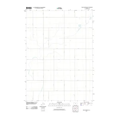
2010 Map of Sioux Rapids SE
USGS Topo · Published 2010About this map
The North Raccoon River meanders across this rural landscape in Buena Vista County, defining the primary drainage pattern of the region. This 2010 topographic survey illustrates the enduring agricultural layout of the Iowa plains, where the Section Land Survey system is reflected in the rigid grid of numbered roads. Major thoroughfares such as Hwy 10 bisect the territory, connecting the scattered farmsteads linked by a network of local routes including 150th Ave and 200th Ave. The terrain is characterized by subtle elevation changes near the riverbanks and a high concentration of section-line roads like 450th St and 520th St, which trace the property boundaries established over a century ago. This map serves as a clear record of the modern rural infrastructure and land use in the heart of the Corn Belt.
Find a feature on this map
16 named features on this map. Tap any name to fly to it.
Don’t see what you’re looking for? This feature index may not catch every label — zoom into the map to look around manually.
Map Details
Editions of this 2010 Sioux Rapids SE Map
This is the sole edition of this map. No revisions or reprints were ever made.
Other maps of this area

1954 · Fort Dodge
USGS Topo · 1:250,000

1957 · Fort Dodge
USGS Topo · 1:250,000

1958 · Fort Dodge
USGS Topo · 1:250,000

1971 · Sioux Rapids SE
USGS Topo · 1:24,000

1971 · Albert City
USGS Topo · 1:24,000

1971 · Rembrandt
USGS Topo · 1:24,000

1971 · Sioux Rapids
USGS Topo · 1:24,000

1971 · Rush Lake West
USGS Topo · 1:24,000

1971 · Webb
USGS Topo · 1:24,000

1979 · Storm Lake
USGS Topo · 1:24,000