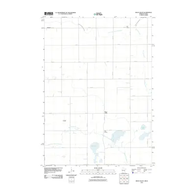
2010 Map of Sioux Valley
USGS Topo · Published 2010About this map
Sioux Valley sits at the heart of this agricultural landscape in Jackson County, where the intricate drainage of the Minnesota-Iowa border region is meticulously documented. The terrain is defined by the winding paths of the Little Sioux River and the West Fork Little Sioux River, alongside significant water bodies like Rush Lake and Skunk Lake. This era shows a highly organized rural grid, where township roads such as 350th Ave and 780th St provide access to isolated homesteads and local landmarks. For genealogists, the map is particularly valuable for its precise location of community burial grounds, including the Norwegian Cemetery, Saint Pauls Cemetery, and the Sioux Valley Cemetery. The extensive network of engineered waterways, such as Judicial Ditch Number Twenty-eight, illustrates the long-standing efforts to manage the prairie wetlands for cultivation.
Find a feature on this map
37 named features on this map. Tap any name to fly to it.
Don’t see what you’re looking for? This feature index may not catch every label — zoom into the map to look around manually.
Map Details
Editions of this 2010 Sioux Valley Map
This is the sole edition of this map. No revisions or reprints were ever made.
Other maps of this area

1954 · Fairmont
USGS Topo · 1:250,000

1958 · Fairmont
USGS Topo · 1:250,000

1960 · Brewster
USGS Topo · 1:24,000

1960 · Okabena
USGS Topo · 1:24,000

1960 · Round Lake
USGS Topo · 1:24,000

1960 · Sioux Valley
USGS Topo · 1:24,000

1970 · Lakefield SW
USGS Topo · 1:24,000

1970 · Okoboji
USGS Topo · 1:24,000

1970 · Lakefield
USGS Topo · 1:24,000

1970 · Harris
USGS Topo · 1:24,000