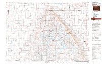
1979 Map of Sisseton
USGS Topo · Published 1980About this map
The Coteau des Prairies plateau dominates this northeastern South Dakota landscape, rising above the surrounding plains and creating a complex network of glacial lakes and sloughs. Much of the eastern portion of the map is defined by the Sisseton Indian Reservation, with the Old Sisseton Indian Agency serving as a significant historical landmark near the community of Sisseton. The regional economy is clearly oriented around the rail lines of the Burlington Northern and the Chicago Milwaukee St Paul and Pacific, which connect agricultural hubs like Britton, Veblen, and Langford. Significant conservation areas, including the Tewaukon National Wildlife Refuge and Roy Lake State Park, underscore the importance of the region's natural hydrology, which includes prominent water bodies such as Buffalo Lake and Pickerel Lake.
Find a feature on this map
61 named features on this map. Tap any name to fly to it.
Don’t see what you’re looking for? This feature index may not catch every label — zoom into the map to look around manually.
Map Details
Editions of this 1979 Sisseton Map
This is the sole edition of this map. No revisions or reprints were ever made.
Other maps of this area

1894 · Hecla
USGS Topo · 1:62,500

1894 · Oakes
USGS Topo · 1:62,500

1895 · Lamoure
USGS Topo · 1:125,000

1895 · Aberdeen
USGS Topo · 1:125,000

1896 · Columbia
USGS Topo · 1:125,000

1904 · Wahpeton
USGS Topo · 1:125,000

1907 · Wyndmere
USGS Topo · 1:125,000

1916 · Peever
USGS Topo · 1:62,500

1917 · New Effington
USGS Topo · 1:62,500

1918 · La Moure
USGS Topo · 1:125,000