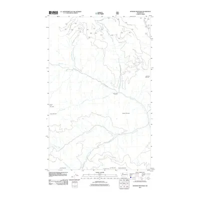
2011 Map of Sitdown Mountain
USGS Topo · Published 2011About this map
Colville Indian Reservation lands dominate this part of the Washington interior, where a network of Bureau of Indian Affairs roads, such as BIA 1052 Rd and BIA 14 Rd, thread through the high country. The landscape is defined by its prominent summits, including Sitdown Mountain and Grizzly Mountain, which overlook a series of drainages like Hall Creek and Sitdown Creek. High-elevation observation points such as Paint Rock Lookout and Lynx Creek Lookout highlight the area's history of forest monitoring and conservation. Local recreation is anchored by the Buckskin Creek Campground, situated near the crossing of County Hwy 99. The mapping of features like Tanker Chance Spring and Sleepy Hollow Creek provides specific reference points for those studying the remote hydrological and geographic patterns of the northern reservation lands.
Find a feature on this map
28 named features on this map. Tap any name to fly to it.
Don’t see what you’re looking for? This feature index may not catch every label — zoom into the map to look around manually.
Map Details
Editions of this 2011 Sitdown Mountain Map
This is the sole edition of this map. No revisions or reprints were ever made.
Other maps of this area

1904 · Republic
USGS Topo · 1:125,000

1936 · Marcus
USGS Topo · 1:96,000

1942 · Marcus
USGS Topo · 1:125,000

1948 · Republic
USGS Topo · 1:62,500

1948 · Sherman Peak
USGS Topo · 1:62,500

1951 · Sherman Peak
USGS Topo · 1:62,500

1951 · Republic
USGS Topo · 1:62,500

1952 · Twin Lakes
USGS Topo · 1:62,500

1953 · Seventeenmile Mtn.
USGS Topo · 1:62,500

1954 · Okanogan
USGS Topo · 1:250,000