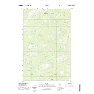
2020 Map of Sitdown Mountain
USGS Topo · Published 2020About this map
Colville National Forest dominates this landscape in Ferry County, where the terrain is defined by high peaks and an intricate network of drainages. Elevation is anchored by Sitdown Mtn, Grizzly Mtn, and the distinctive Paint Rock, with smaller peaks like Lynx Mtn and Bitterfoot Mtn punctuating the southern border. The hydrology of the area is particularly detailed, tracing the winding paths of Hall Cr, Grizzly Cr, and the appropriately named Sleepy Hollow Cr.
Find a feature on this map
28 named features on this map. Tap any name to fly to it.
Don’t see what you’re looking for? This feature index may not catch every label — zoom into the map to look around manually.
Map Details
Editions of this 2020 Sitdown Mountain Map
This is the sole edition of this map. No revisions or reprints were ever made.
Other maps of this area

1904 · Republic
USGS Topo · 1:125,000

1936 · Marcus
USGS Topo · 1:96,000

1942 · Marcus
USGS Topo · 1:125,000

1948 · Republic
USGS Topo · 1:62,500

1948 · Sherman Peak
USGS Topo · 1:62,500

1951 · Sherman Peak
USGS Topo · 1:62,500

1951 · Republic
USGS Topo · 1:62,500

1952 · Twin Lakes
USGS Topo · 1:62,500

1953 · Seventeenmile Mtn.
USGS Topo · 1:62,500

1954 · Okanogan
USGS Topo · 1:250,000