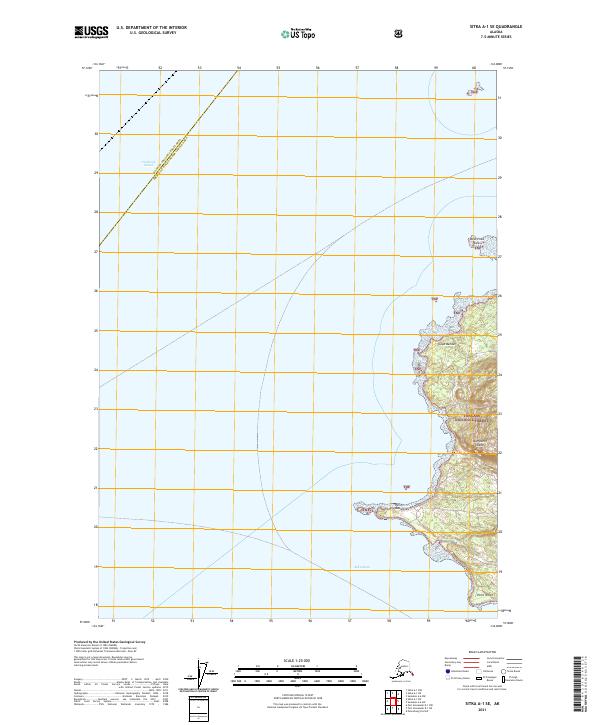
2021 Map of Sitka A-1 SE
USGS Topo · Published 2021About this map
Kupreanof Island occupies the southeastern corner of this maritime chart, where the wilderness of the Tongass National Forest meets the tides of the Alexander Archipelago. This coastal section is defined by a series of prominent nautical landmarks, including Point Macartney and Point White, which bracket the western edge of the island. The chart details the transition between the open waters of Frederick Sound and the more protected passage of Keku Strait, offering a clear view of the shoreline topography.
Find a feature on this map
13 named features on this map. Tap any name to fly to it.
Don’t see what you’re looking for? This feature index may not catch every label — zoom into the map to look around manually.
Map Details
Editions of this 2021 Sitka A-1 SE Map
This is the sole edition of this map. No revisions or reprints were ever made.
Other maps of this area

1948 · Sumdum A-6
USGS Topo · 1:63,360

1948 · Petersburg D-6
USGS Topo · 1:63,360

1948 · Port Alexander D-1
USGS Topo · 1:63,360

1948 · Sitka A-1
USGS Topo · 1:63,360

1951 · Sitka
USGS Topo · 1:250,000

1951 · Port Alexander
USGS Topo · 1:250,000

1951 · Petersburg D-6
USGS Topo · 1:63,360

1952 · Petersburg
USGS Topo · 1:250,000

1952 · Port Alexander
USGS Topo · 1:250,000

1952 · Sumdum
USGS Topo · 1:250,000