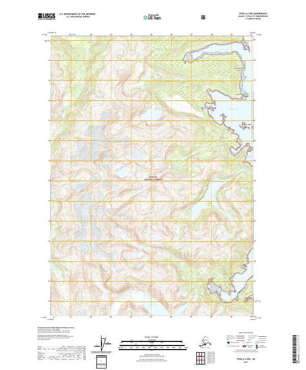
2021 Map of Sitka A-3 NW
USGS Topo · Published 2021About this map
The southeastern coast of Baranof Island within the Tongass National Forest is defined by sharp elevation changes and deep coastal indentations. Water dominates the landscape, from the glacial runoff of the Glacier River to the inland basins of Kasnyku Lake and Takatz Lake. The intricate shoreline along the eastern edge of the quadrangle features several protected anchorages, including Cosmos Cove, Kasnyku Bay, and Waterfall Cove. Vertical landmarks like Graystone Cliff tower over the coastline near North Point, illustrating the challenging maritime geography of the Alexander Archipelago. This modern survey provides an exact record of the hydrological network, including Kasnyku Cr and Takatz Cr, as they flow from the high interior peaks toward the saltwater of the passage.
Find a feature on this map
23 named features on this map. Tap any name to fly to it.
Don’t see what you’re looking for? This feature index may not catch every label — zoom into the map to look around manually.
Map Details
Editions of this 2021 Sitka A-3 NW Map
This is the sole edition of this map. No revisions or reprints were ever made.
Other maps of this area

1948 · Sitka B-3
USGS Topo · 1:63,360

1948 · Sitka A-3
USGS Topo · 1:63,360

1951 · Sitka B-4
USGS Topo · 1:63,360

1951 · Sitka
USGS Topo · 1:250,000

1951 · Sitka A-4
USGS Topo · 1:63,360

1951 · Sitka B-3
USGS Topo · 1:63,360
1951 · Sitka A-3
USGS Topo · 1:63,360

1952 · Sitka
USGS Topo · 1:250,000

1954 · Sitka A-4
USGS Topo · 1:63,360

1964 · Sitka
USGS Topo · 1:250,000