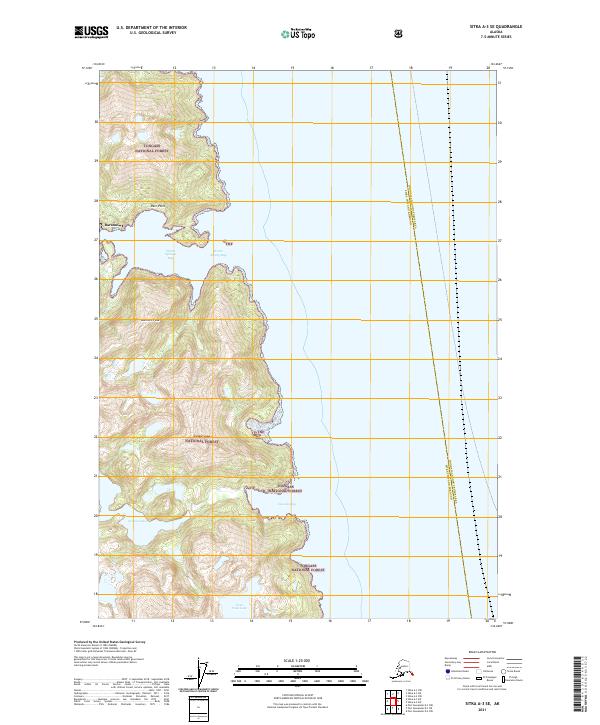
2021 Map of Sitka A-3 SE
USGS Topo · Published 2021About this map
Baranof sits at the edge of the wilderness on the eastern coast of Baranof Island, serving as a gateway to the mountainous interior of the Tongass National Forest. This 2021 survey illustrates the dramatic elevation changes of the Alexander Archipelago, where the summit of Bahovec Peak rises steeply above the waters of Warm Springs Bay. The shoreline is defined by protected inlets and freshwater sources like Carbon Lake and Four Falls Lake, which drain into the saltwater bays via features such as Cascade Bay. The map also delineates the administrative boundary between the Sitka City and Borough and the Hoonah-Angoon Census Area, which runs through the open waters east of Deer Point. This geography reflects the isolated, water-dependent nature of Southeast Alaskan settlements where terrestrial travel is limited by steep terrain.
Find a feature on this map
14 named features on this map. Tap any name to fly to it.
Don’t see what you’re looking for? This feature index may not catch every label — zoom into the map to look around manually.
Map Details
Editions of this 2021 Sitka A-3 SE Map
This is the sole edition of this map. No revisions or reprints were ever made.
Other maps of this area

1948 · Sitka A-3
USGS Topo · 1:63,360

1948 · Sitka A-2
USGS Topo · 1:63,360

1951 · Sitka
USGS Topo · 1:250,000

1951 · Port Alexander D-3
USGS Topo · 1:63,360

1951 · Port Alexander
USGS Topo · 1:250,000

1951 · Port Alexander D-2
USGS Topo · 1:63,360

1951 · Sitka A-2
USGS Topo · 1:63,360
1951 · Sitka A-3
USGS Topo · 1:63,360

1952 · Port Alexander
USGS Topo · 1:250,000

1952 · Sitka
USGS Topo · 1:250,000