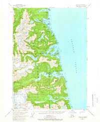
1951 Map of Sitka A-3
USGS Topo · Published 1966About this map
Baranof Island is documented here as it appeared in the mid-20th century, revealing a landscape defined by dramatic coastal inlets and interior freshwater lakes within the Tongass National Forest. The settlement at Baranof on Warm Springs Bay serves as a focal point, supported by maritime infrastructure including a Seaplane Base, a Gaging Station, and a Dock. This area is characterized by short, steep water systems where names like Hidden Falls Lake and Kasnyku Falls suggest the rapid descent from high peaks to the sea.
Find a feature on this map
44 named features on this map. Tap any name to fly to it.
Don’t see what you’re looking for? This feature index may not catch every label — zoom into the map to look around manually.
Map Details
Editions of this 1951 Sitka A-3 Map
2 editions found
Other maps of this area

1948 · Sitka B-3
USGS Topo · 1:63,360

1948 · Sitka A-3
USGS Topo · 1:63,360

1948 · Sitka A-2
USGS Topo · 1:63,360

1948 · Sitka B-2
USGS Topo · 1:63,360

1951 · Sitka B-4
USGS Topo · 1:63,360

1951 · Sitka
USGS Topo · 1:250,000

1951 · Port Alexander D-4
USGS Topo · 1:63,360

1951 · Port Alexander D-3
USGS Topo · 1:63,360

1951 · Port Alexander
USGS Topo · 1:250,000

1951 · Port Alexander D-2
USGS Topo · 1:63,360