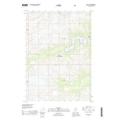
2017 Map of Sitka A-3 SW
USGS Topo · Published 2017About this map
Baranof sits at the edge of Warm Spring Bay on the eastern coast of Baranof Island, serving as a focal point for this coastal wilderness. The settlement is anchored by its proximity to Baranof Lake, where the Baranof River drains toward the sea. This landscape within the Tongass National Forest is defined by dramatic elevation changes, rising from the shoreline to the heights of Mt Furuhelm. The hydrologic network is dense, featuring several isolated upland water bodies including Takatz Lake, Sadie Lake, and Carbon Lake, alongside the drainage of Takatz Cr. The presence of O'Neil Island just offshore provides a natural sheltered harbor, emphasizing the maritime character of this remote Alaskan outpost within the Sitka City and Borough boundary.
Find a feature on this map
12 named features on this map. Tap any name to fly to it.
Don’t see what you’re looking for? This feature index may not catch every label — zoom into the map to look around manually.
Map Details
Editions of this 2017 Sitka A-3 SW Map
This is the sole edition of this map. No revisions or reprints were ever made.
Other maps of this area

1948 · Sitka A-3
USGS Topo · 1:63,360

1951 · Sitka
USGS Topo · 1:250,000

1951 · Port Alexander D-4
USGS Topo · 1:63,360

1951 · Port Alexander D-3
USGS Topo · 1:63,360

1951 · Port Alexander
USGS Topo · 1:250,000

1951 · Sitka A-4
USGS Topo · 1:63,360
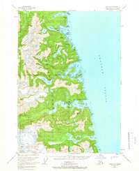
1951 · Sitka A-3
USGS Topo · 1:63,360

1952 · Port Alexander
USGS Topo · 1:250,000

1952 · Sitka
USGS Topo · 1:250,000

1954 · Sitka A-4
USGS Topo · 1:63,360