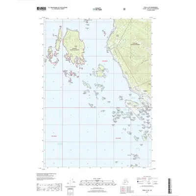
2017 Map of Sitka A-5 SE
USGS Topo · Published 2017About this map
Sitka occupies the western shoreline of Baranof Island on this 2017 survey, serving as a maritime and aviation hub amidst the islands of Sitka Sound. The intricate coastline is defined by protected waterways like Whiting Harbor and Western Anchorage, which separate the mainland town from Japonski Island and the Sitka Rocky Gutierrez Airport. This contemporary map details the complex geography of the Alexander Archipelago, showing the town's expansion along Halibut Point Road and into the foothills of Harbor Mt. / Gavan Hill. Local heritage is marked by several significant landmarks, including the Russian Cem and Lutheran Cem, as well as Princess Maksutov's Grave, reflecting the area's deep history. The vast wilderness of the Tongass National Forest begins at the town's edge, while offshore, groups like the Kasiana Islands and Apple Islands dot the Gulf Of Alaska.
Find a feature on this map
99 named features on this map. Tap any name to fly to it.
Don’t see what you’re looking for? This feature index may not catch every label — zoom into the map to look around manually.
Map Details
Editions of this 2017 Sitka A-5 SE Map
This is the sole edition of this map. No revisions or reprints were ever made.
Other maps of this area

1948 · Sitka A-5
USGS Topo · 1:63,360

1951 · Port Alexander D-5
USGS Topo · 1:63,360

1951 · Sitka
USGS Topo · 1:250,000

1951 · Port Alexander D-4
USGS Topo · 1:63,360

1951 · Port Alexander
USGS Topo · 1:250,000

1951 · Sitka A-4
USGS Topo · 1:63,360

1951 · Sitka A-5
USGS Topo · 1:63,360

1952 · Port Alexander
USGS Topo · 1:250,000

1952 · Sitka
USGS Topo · 1:250,000

1954 · Sitka A-4
USGS Topo · 1:63,360